Nordkajen Vejle
Location
Vejle, Denmark
Project leader
Viktor Blicher Forchhammer
Type of contract
Competition entry
Client
Vejle Kommune
Collaboration
Holscher Nordberg
A Vibrant New Nordkaj
The overall concept for the development of Nordkajen’s landscape is rooted in Vejle’s historical identity as a town in the middle of the fjord. On a small hill just north of where the river meets the fjord, the town’s first inhabitants settled in the 13th century. The name Vejle itself comes from the Old Danish word wæthel, meaning “ford.” The location at the end of the fjord, surrounded by the green hills rising on both sides, has always been an essential part of the town’s character.
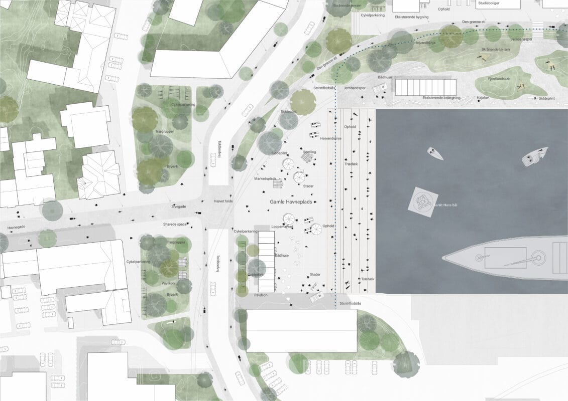
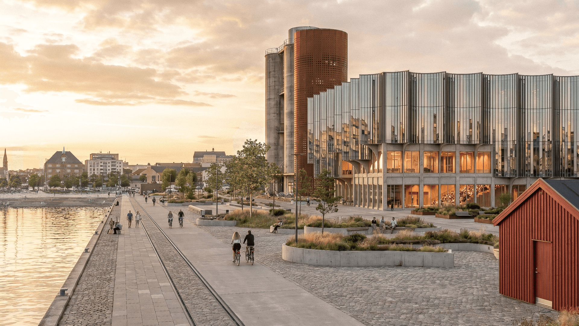
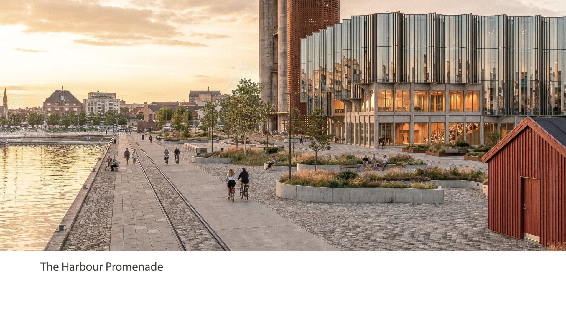
The old harbour square
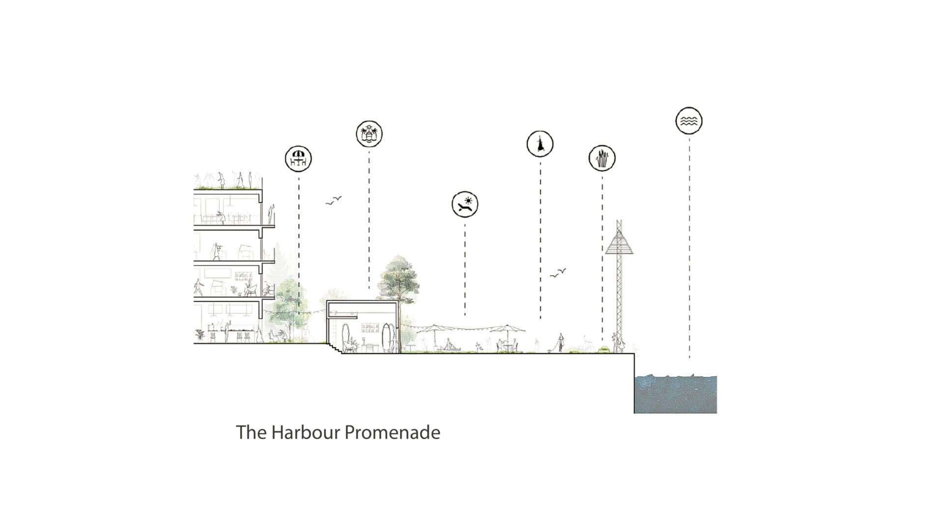
A new social heart of the city
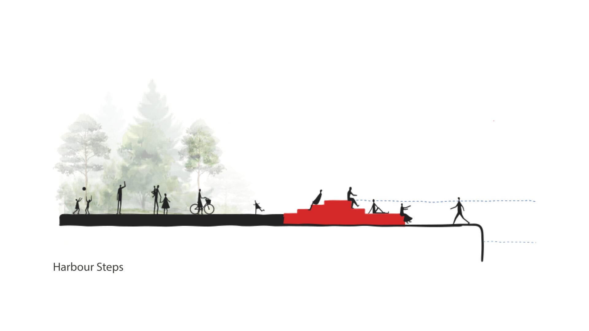
The Harbour Square is Vejle’s new front facing the fjord. This is where Nordkajen connects to the city. The square should feel calm, strong, and beautiful — an urban space defined by few interventions and high precision. We imagine a single, simple feature here: a water sculpture, a timber staircase, or another clear architectural element that gives the square its identity.
We propose a timber staircase with two broad steps up and six steps descending toward the water. The staircase is not only a place to stay and gather; flood protection is integrated directly into its form. It keeps the city dry — and does so with dignity. At the same time, it creates shelter, direction, and a graceful movement down toward the fjord.
Here, people can sit in the morning sun or linger after work in the evening light. The space can host small concerts, informal events, and everyday life close to the water. The fishing huts provide room for cafés and street food. It is simple, welcoming, and lively.
From a traffic perspective, we continue to work with the simplest possible solution. Both the partially sunken road solution and the tunnel solution are heavy interventions — expensive, resource-intensive, and with consequences elsewhere in the system. By simplifying traffic flow and avoiding unnecessary intersections, the Harbour Square can be freed up as one large, cohesive public space.
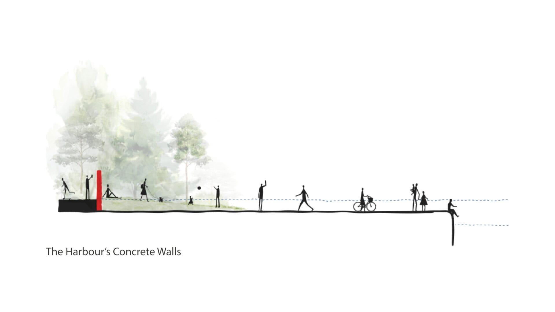
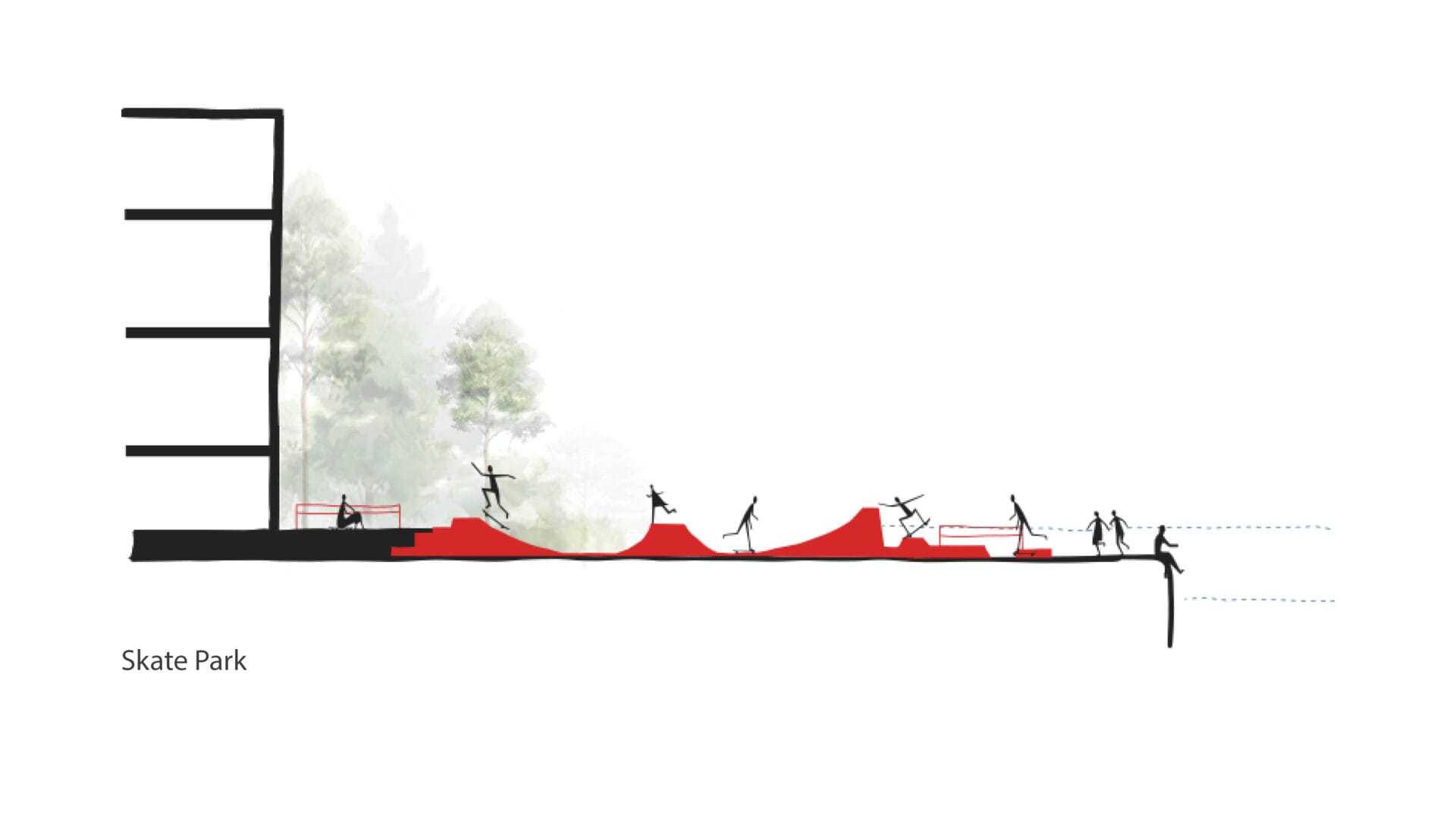
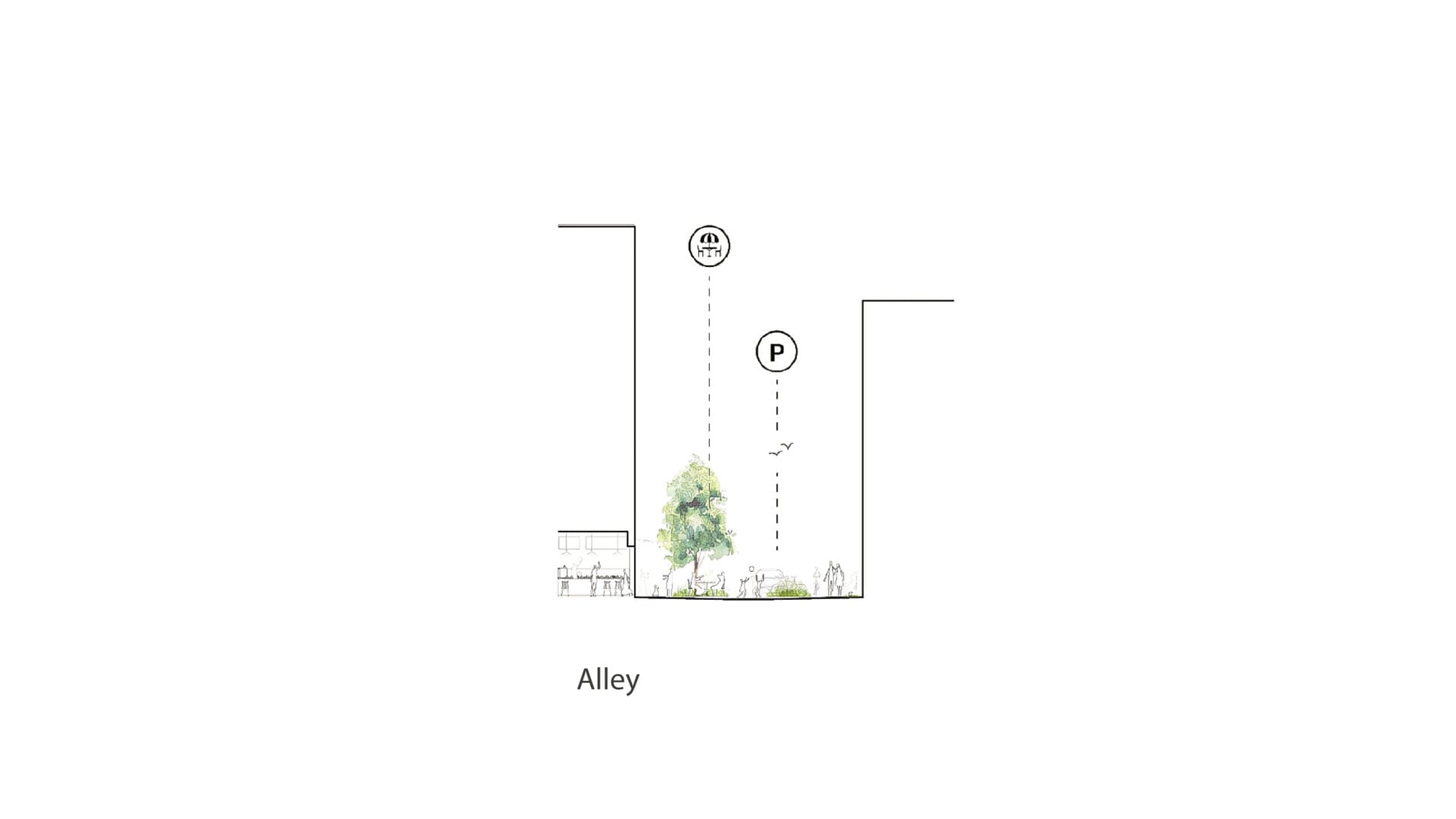
Flood protection
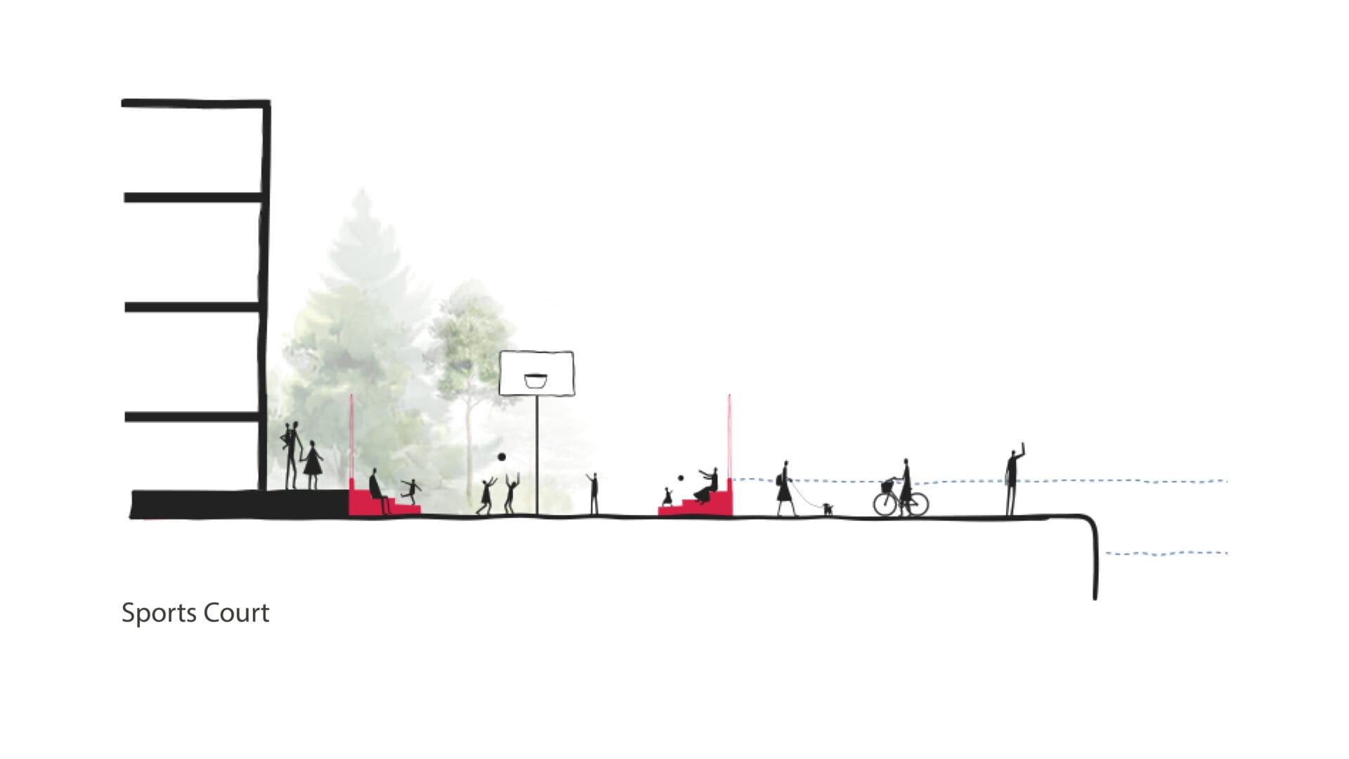
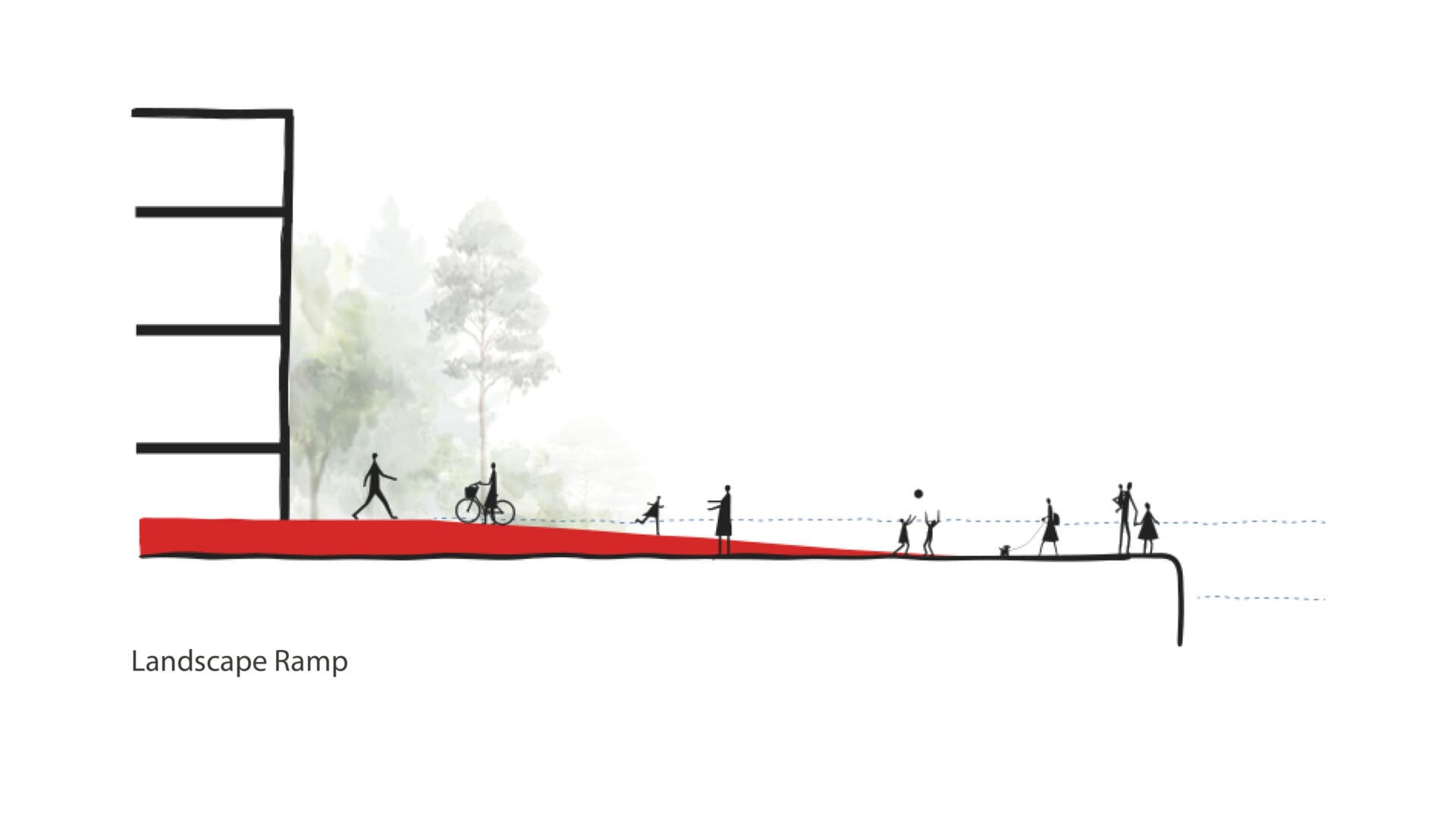
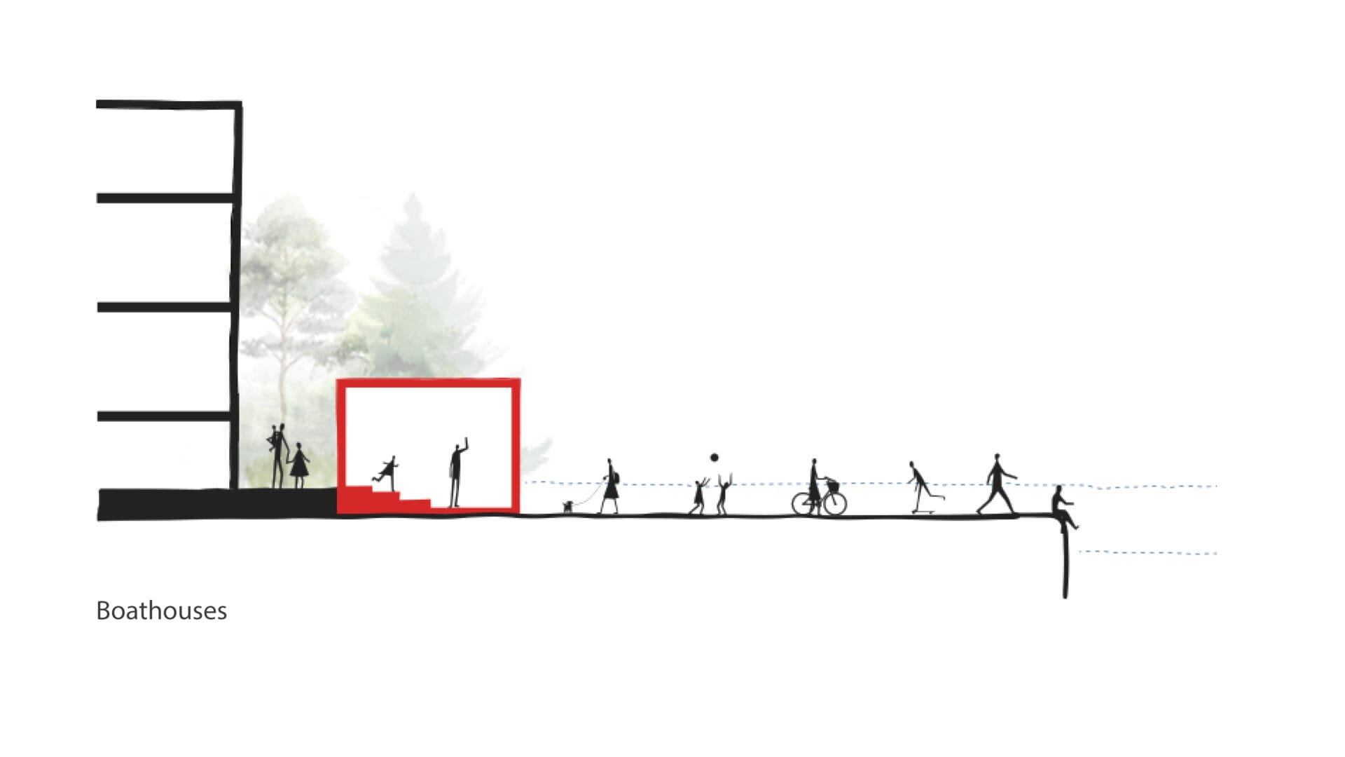
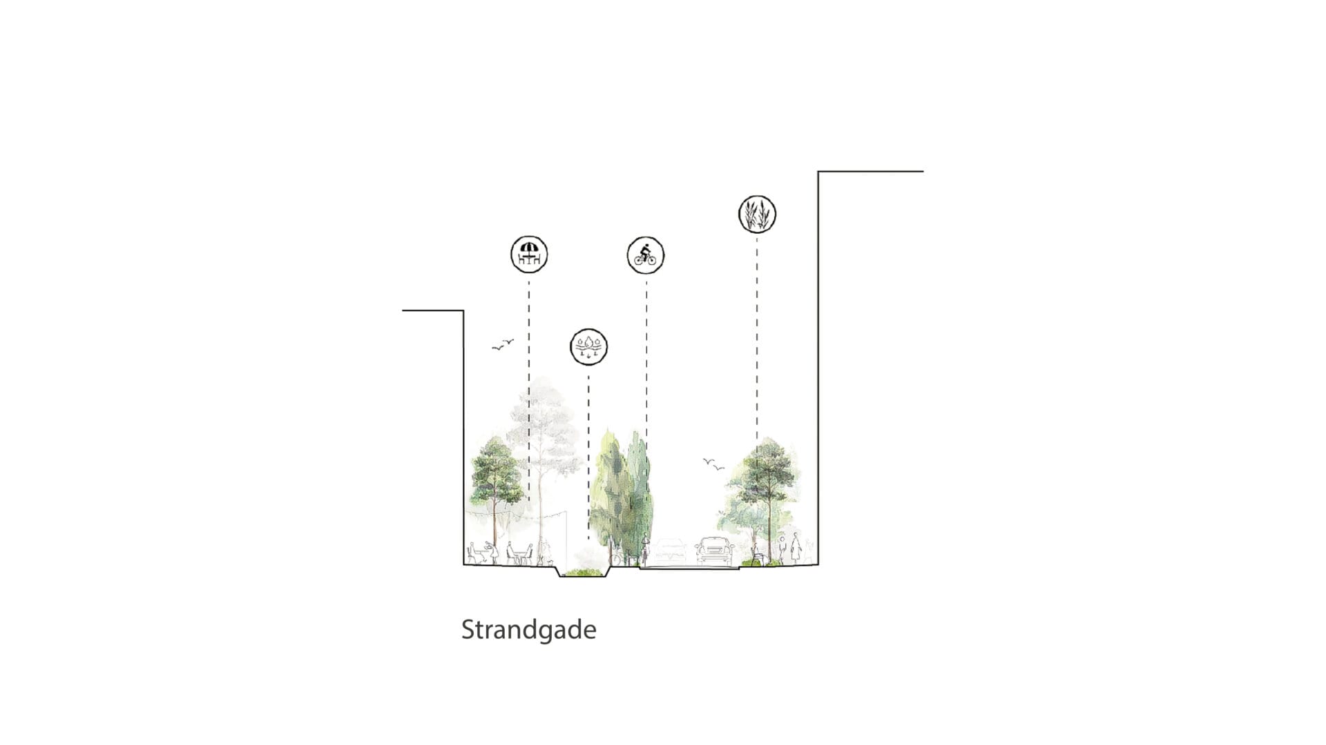
Flood protection up to elevation 2.50 is conceived as a flexible solution. Inspired by the fjord landscape, the protection line winds organically through Nordkajen, rising as a soft green edge — not as a wall, not as a technical installation, but as a new landscape within the harbour.
It becomes a movement through the area: in some places rising, in others stepping back to make room for the quay’s new urban life — seating steps, fishing huts, a skate park, and a basketball court.
This strategy makes it possible to reuse the quay’s existing buildings, materials, and surfaces. Cobblestones, railway tracks, and the quay edge can all be preserved and carried forward. Areas currently at elevation 1.80 are, as a starting point, retained. What is raised becomes new.
In this way, the harbour’s character is preserved. It is a deliberate transformation strategy in which we build on what already exists, reduce resource consumption, and retain the raw materiality and weight of the industrial harbour.
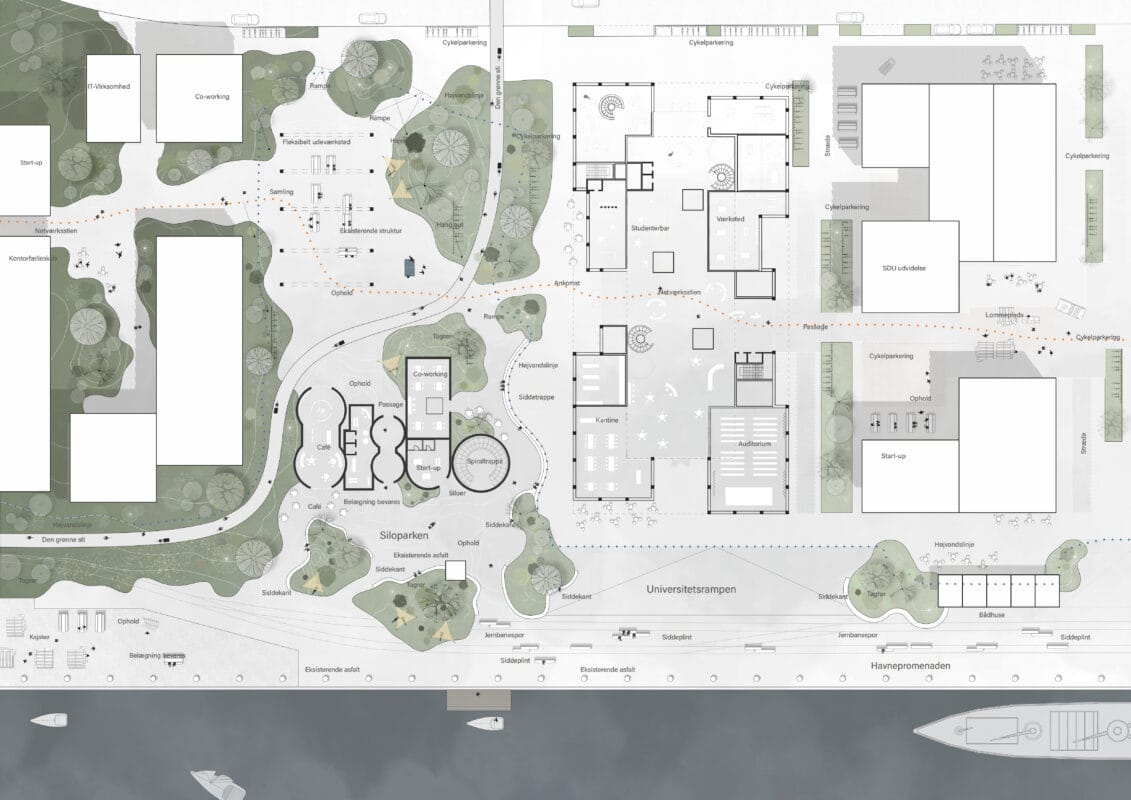
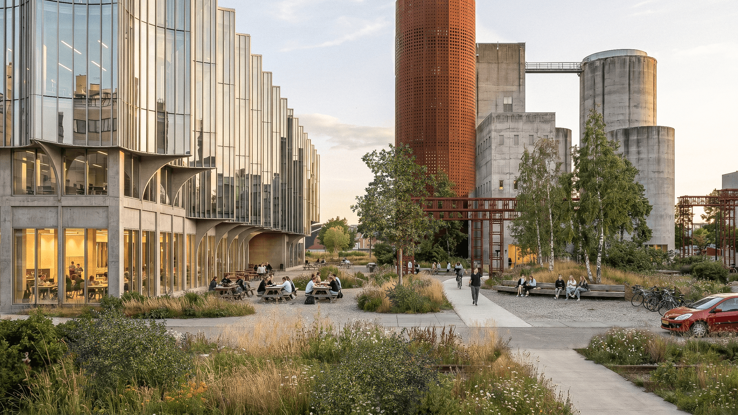
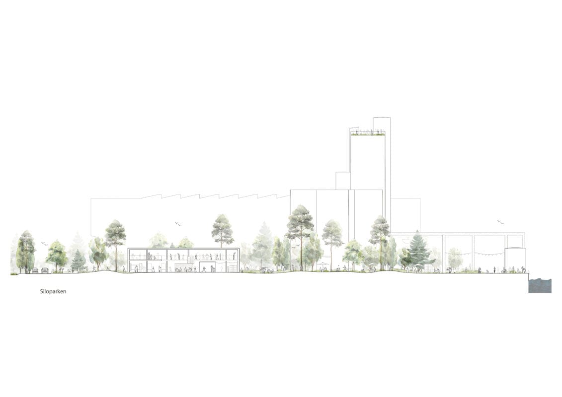
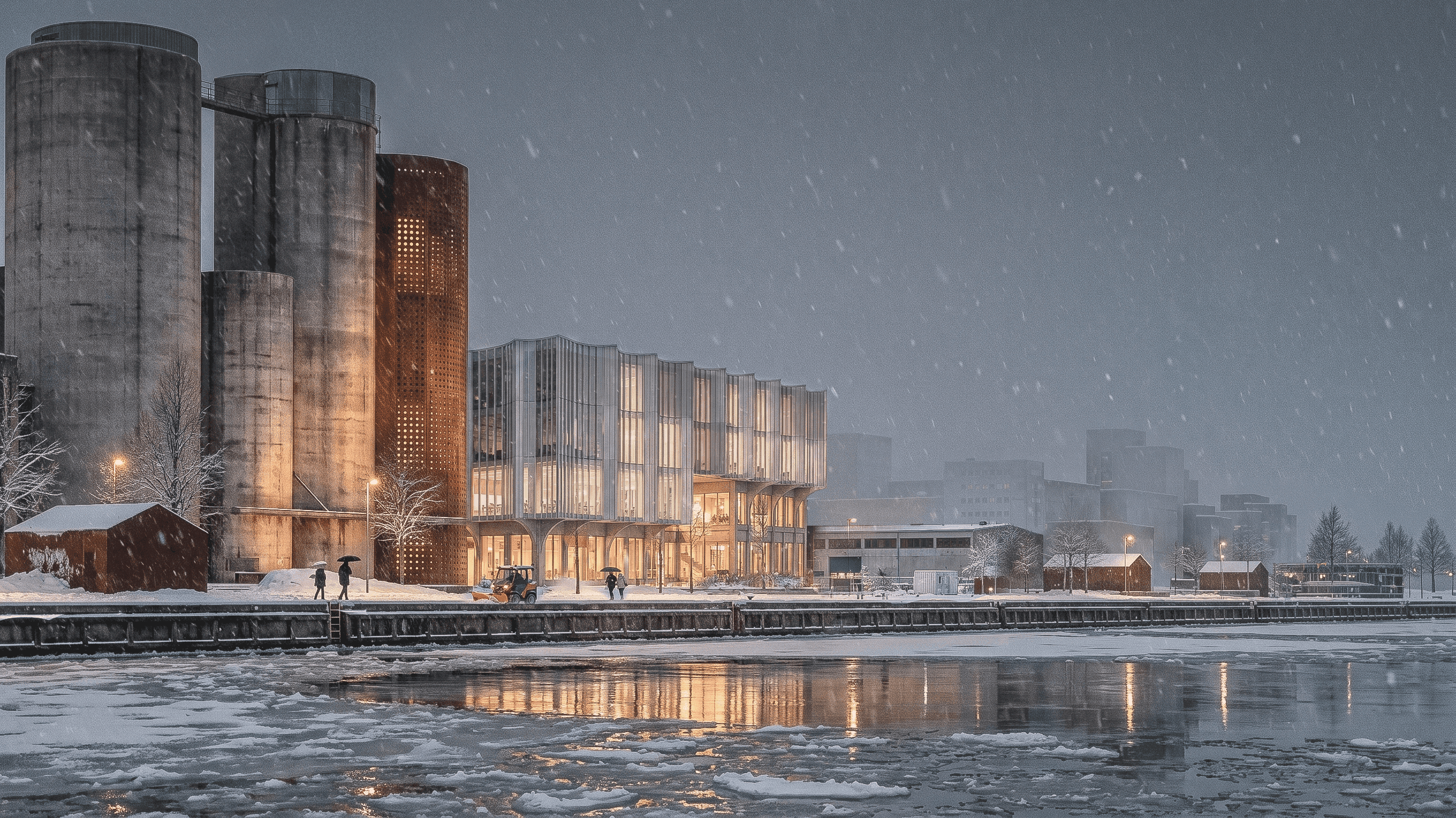
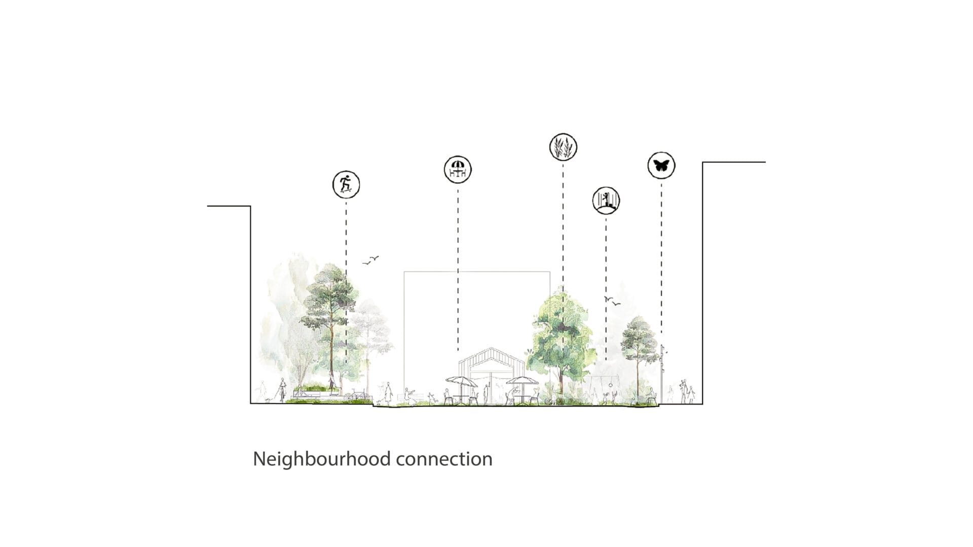
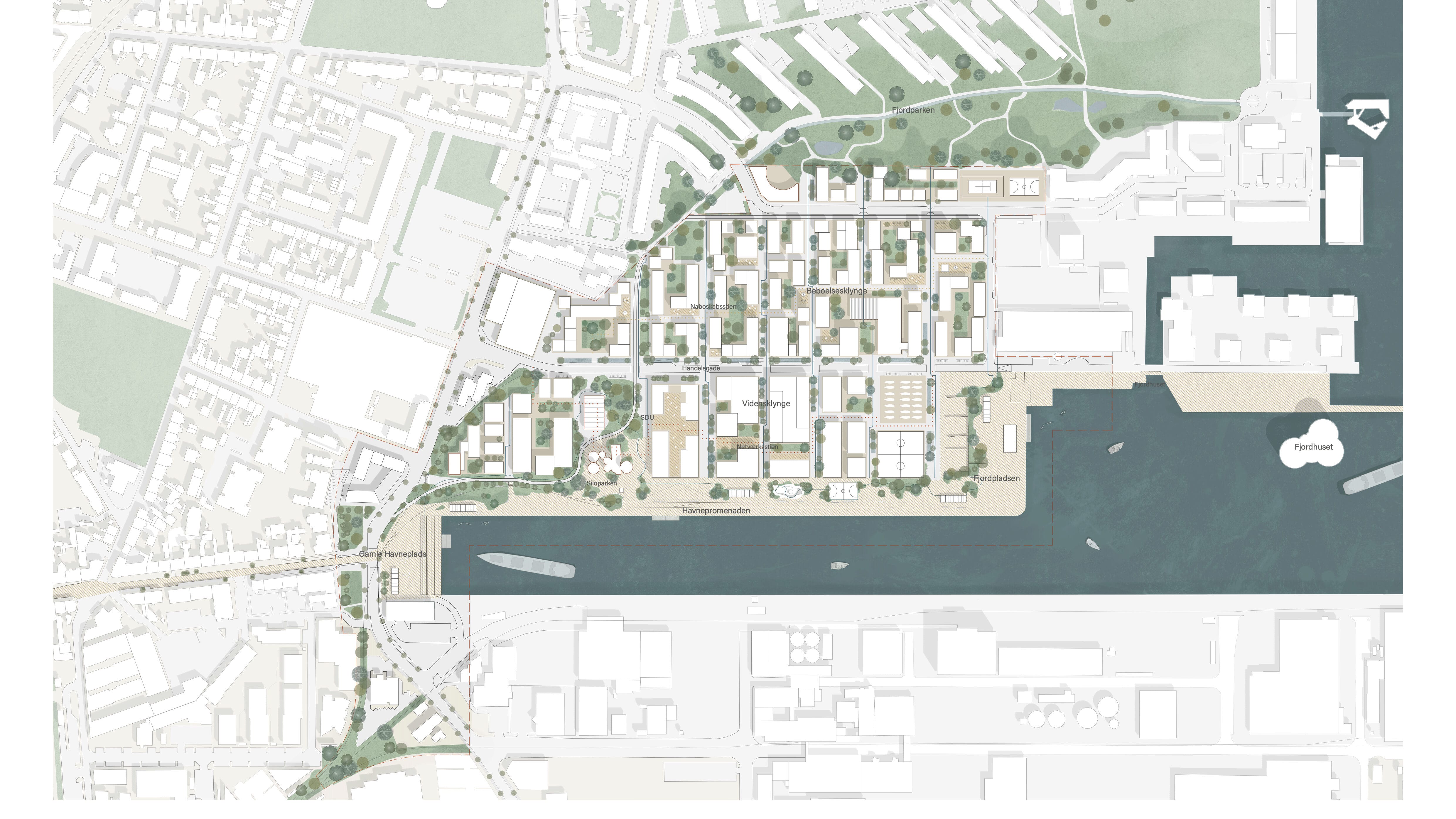
The Silo Park
Recreational and Industrial
The Silo Park functions both as SDU’s campus area and as a public park. Our ambition is to create a park that feels green, lush, and densely planted — and above all, welcoming in contrast to the more rugged harbour promenade. Here, the flood protection is drawn in around the silo so that the existing industrial paving and railway tracks along the promenade can be preserved. We also propose preserving the silos themselves as landmarks within the park.
Here, the flood protection takes several forms: as a timber bench for seating, as a gently sloping ramp leading up to the building, and as softly shaped earth mounds. The building itself is positioned with a finished floor level above the flood protection line.
Many of the plan’s strategic elements are visible here in particular: the network path running through SDU, the close connection between outdoor areas and ground floors, the soft and organic flood protection, the open promenade along the waterfront, the small multifunctional fishing huts, the mobile floating pontoons, the commercial street, and the placement of bicycle parking along the urban street.
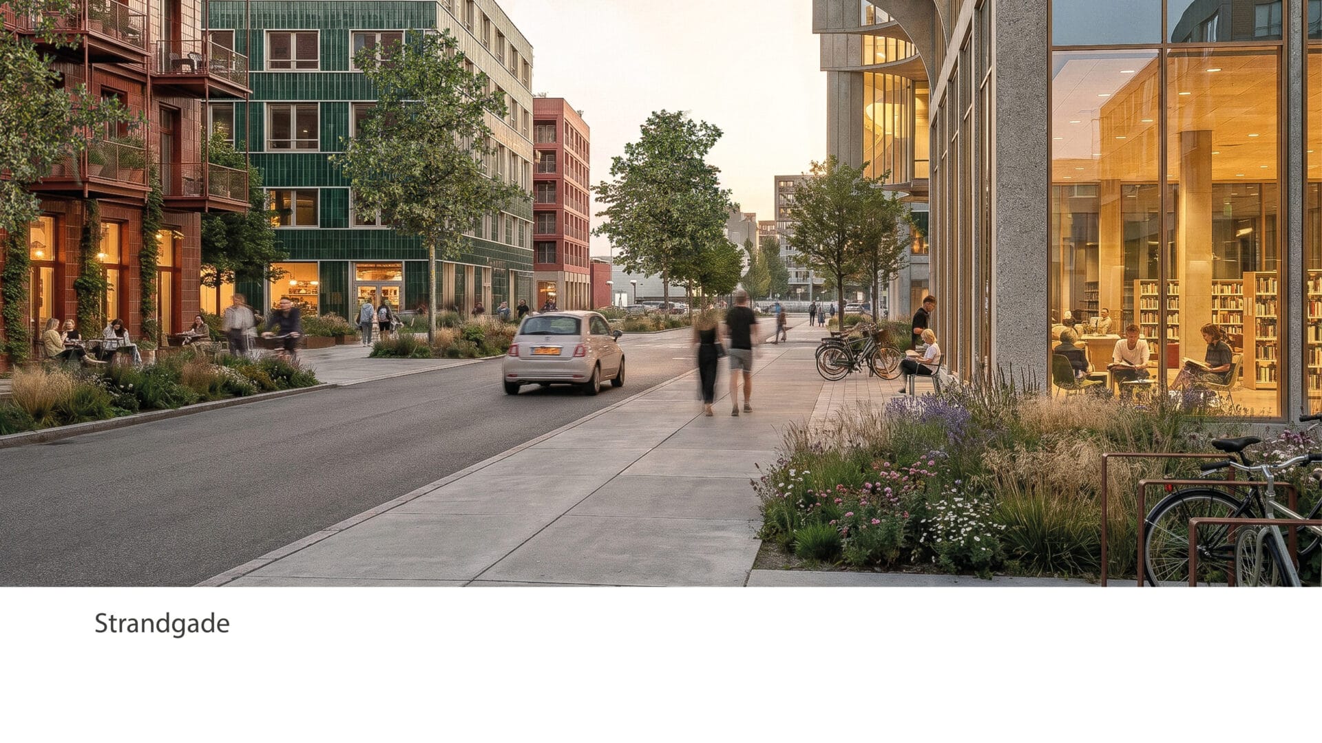
The Green Street Network
In Fjordbyen, good accessibility is created for all forms of transport, but both the urban structure and the design of the streets prioritise cyclists and pedestrians.
Primary car traffic is concentrated on a few main roads, while two mobility hubs accommodate most parking, ensuring that streets and public spaces are not dominated by parked cars.
A fine-grained network of paths, with significant spatial and atmospheric variation, makes it easy and enjoyable to move through the district on foot or by bicycle.
Mobility hubs as generators of urban life
The plan proposes concentrating car parking in two mobility hubs in order to avoid excessive walking distances and to ensure that the buildings are scaled appropriately for the district and can be developed in an economically and physically rational way. Their placement supports efficient traffic flow through the district and creates strong opportunities for shared use between housing, education, business, visitors, and tourists.
Both mobility hubs should include outward-facing functions at ground level. One could contain a supermarket, while the other could house a local recycling station, making local reuse and recycling easy and accessible.
Competition entry 2026
Want to learn more?
Contact Viktor Blicher Forchhammer
vfm@kragh-berglund.dk
+45 24 42 91 24